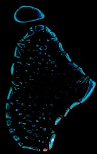
 How much the oceans are protected? How much of the globe is covered in coral reefs? These are important questions that require decent data. A new study led by Sea Around Us Project member Colette Wabnitz and just released online by the journal Frontiers in Ecology and the Environment reveals that the current data available are too poor for them to be used to evaluate progress toward conservation targets, such as international goals to set aside 20-30% of the oceans as marine protected areas. Technological advances in satellite imagery, like this image of the North Male atoll in the Maldives, can help us better determine the true size of coral reefs, mangroves, seagrass, spawning grounds, and other vulnerable marine habitats. Read the full study here.

