Google Earth reveals unreported fishing

Screen shot 2012-09-19 at 1.24.15 PMIn the Persian Gulf, large, semi-permanent fish traps take advantage of tidal differences to catch a wide variety of marine species. These traps, called fish weirs, have been used around the world for thousands of years, but only recently have researchers quantified what they catch using imagery captured from space.

In a new study published today in the ICES Journal of Marine Science, Sea Around Us Project researchers used satellite imagery from Google Earth to estimate that there were 1,900 fishing weirs along the coast of the Persian Gulf during 2005 and that they caught approximately 31,000 tonnes of fish that year. This catch is almost six times larger than the official amount (5,260 tonnes) reported by the seven countries in the region to the United Nation’s Food and Agriculture Organization.


This study highlights the utility of Google Earth and other remote sensing tools for validating catch statistics and fisheries operations in general.

You can find out more about the study here:
Press release from the University of British Columbia,
Web feature summarizing the study from The Pew Charitable Trusts,
Journal article published in ICES Journal of Marine Science.

Al-Abdulrazzak D and Pauly D (2013) Managing fisheries from space: Google Earth improves estimates of distant fish catches. ICES Journal of Marine Science. doi:10.1093/icesjms/fst178


ELEFAN in (Daka)R

Participants

During June, Deng Palomares and Daniel Pauly spent a week teaching a newly updated version of the ELEFAN software at the Institute for Fisheries and Aquaculture of the University Cheick Anta Diop of Dakar, Senegal. (Photo: Najih Lazar)

by M.L. ‘Deng’ Palomares and Daniel Pauly

The ELEFAN software and approach for the estimation of von Bertalanffy growth parameters from length-frequency data was developed at the International Center for Living Aquatic Resources Management (ICLARM), in Manila, Philippines, in the early 1980s by Daniel Pauly and two programmers (Noel David and Felimon Gayanilo). It was disseminated in various versions throughout the world, especially in tropical countries, through a series of training courses during the 1980s and 1990s. It also formed the core of a comprehensive software package called FAO-ICLARM Stock Assessment Tools (FiSAT; [1], [2]), still available from the FAO.

Overall, about 5,500 papers based on the ELEFAN approach, as incorporated in FiSAT and its predecessors have been published in the past 30+ years (as identified by Google Scholar records with “ELEFAN” in the title or the body of the text). However, since its release, FiSAT has been updated only once (FiSAT II; [3]), and it has become outdated in content and form. Thus, the offer was accepted to collaborate with USAID’s COMFISH Project in Senegal to produce an updated version of ELEFAN and to test it in a training course in Dakar before releasing it for wider use as open-source software.

The bulk of the R coding was completed by Aaron Greenberg (with Mathieu Colléter also contributing a routine) just in time for a team consisting of Ted Hart (of UBC’s Biodiversity Research Centre), Danielle Knip and Deng Palomares (of the Sea Around Us Project) to create a stand-alone package copied on 25 USB sticks at the end of May.

Daniel Pauly and Deng Palomares then spent a week in an ELEFAN training course, held at the Institute for Fisheries and Aquaculture of the University Cheick Anta Diop of Dakar, teaching the routines behind and the functioning of the ELEFAN package. The group of 25 Senegalese participants consisted of about one-half fisheries scientists and graduate students, and the other half of fisheries inspectors.

While the fisheries inspectors struggled somewhat with the relevance of growth and mortality estimations and clearly preferred Daniel’s lectures on fisheries and climate change issues, the students and scientists benefitted greatly from this training workshop and generated – with Deng’s help – results for sardinella (Sardinella aurita, S. maderensi), white grouper or thiof (Epinephelus aeneus), bonga (Ethmalosa fimbriata) and other species. The results – to our relief – were comparable to those obtained by a group of colleagues (also working for the COMFISH Project) through tedious reading of annual rings on bony structures. Indeed, in the case of octopus (where the cubic root of the weight was used instead of length), results were obtained which could not have been obtained though ageing of bony structures – octopi
have no bones…

Thus, overall, the personnel who had arranged the workshop, notably COMFISH Project Leader Chris Mathews and Najih Lazar, Technical Advisor, both of The University of Rhode Island, were as pleased as we were about both the knowledge that was passed on during the workshop and the performance of the trial version of ELEFAN in R. Obviously, a number of items were noted which require improvement, as well as a swarm of bugs, both of which are due to be fixed in the next two to three months. The high hopes that we have for this new release of ELEFAN in R appear justified.

Daniel used the opportunity of being in Senegal to visit the Département des Pêches Maritimes, where he briefed its Director, Mr. J.-P. Manel, and members of his senior staff on the results of the reconstruction of Senegalese marine catches led by Dyhia Belhabib, with support from the MAVA Foundation and co-authors from the COMFISH project (Ms. Vivianne Koutob), the DPM (Mr. Lamine Mbaye) and WWF-Senegal (Mr. Nassirou Gueye). It was very gratifying that our Senegalese partners acknowledged that they have catch-reporting problems, both with regards to substantial illegal fishing in Senegalese waters and unregulated fishing by Senegalese fishers in the waters of neighbouring countries. This acceptance of reality signifies a level of political maturity that is lacking in many other countries where officialdom prefers to stick its head in the sand.

Daniel also used the opportunity, shortly before leaving Dakar, to hold a press conference with a dozen Senegalese journalists to inform them of a recent study authored by Drs William Cheung, Reg Watson and himself, on global warming and fisheries, which implies a dire future for tropical fisheries. One of the workshop participants suggested to Daniel that the public should be “alerted, but not alarmed” by the trend that this paper describes and the implication for Senegalese fisheries. This point to alert people and not alarm them is an excellent formulation of our job as scientists, and luckily, the Senegalese journalists followed up on it. For those who speak French, you can verify that the Senegalese journalists got the point by reading this article published in Le Soleil Online (www.lesoleil.sn), as an example.

Daniel can also attest that Deng was a big success with the national dress that she was given by the participants (see picture, right)!

References
[1] Gayanilo FC, Sparre P and Pauly D (1996) FAO-ICLARM stock assessment tools (FiSAT). User’s guide. FAO Computerized Information Series No. 8. FAO, Rome. 126 p.
[2] Gayanilo FC and Pauly D (1997) FAO-ICLARM stock assessment tools: reference manual. FAO Computerized Information Series No. 8. FAO, Rome. x+262 p.
[3] Gayanilo FC, Sparre P and Pauly D (2005) FAO-ICLARM stock assessment tools II (FiSAT II). Revised version. User’s guide. FAO Computerized Information Series No. 8. FAO, Rome. vii+168 p.


Correction: This is an updated version of the original article, correcting erroneous affiliations.

Ambassador to West Africa

DSC03963by Dyhia Belhabib

“Our driftnets don’t produce discards.”
“We don’t have illegal fishing – it’s illegal.”
“Your methods are correct, but your results don’t make sense.”
“Don’t tell them we fish in their waters, they will deny us access.”

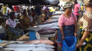
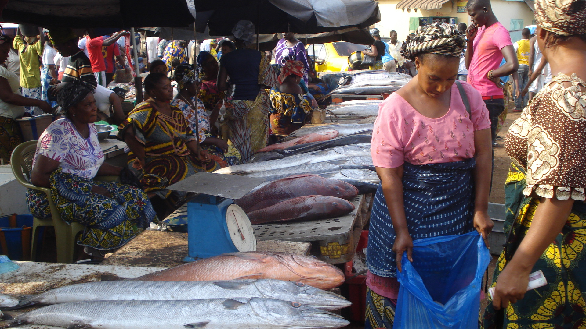
These were some of the amazing comments I heard during my short visit to seven West African countries earlier this year as part of the “Sea Around Us Project and PRCM: Marine Conservation Research, Collaboration and Support in West Africa.” (PRCM is the Regional Marine and Coastal Conservation Programme for West Africa). During my trip, I met with fisheries experts, researchers, decision-makers, NGOs and industry representatives to ground-truth the catch reconstruction results for the different countries.

I landed in Dakar on 4 April and met with the USAID Collaborative Management of Sustainable Fisheries in Senegal (COMFISH) team early the next day. Going through the presentation of Christopher Mathews (director of USAID/COMFISH in Senegal) for the upcoming meetings, made me realize how sensitive the subject of catch reconstructions was, and how diplomatic I would need to be. I would have to choose my words wisely.

The morning of April 6th, the Senegal workshop began. Around 85 people showed up, notably, the Department of Fisheries (DPM), the Fisheries Research Institute (CRODT), WWF, industrial and artisanal fisheries representatives, the Department of Fisheries Monitoring and Surveillance (DPSP), the US Navy, the local university and women from the fish processing industry, as well as the media. The main goal of the workshop was to validate catch reconstruction results and identify potential collaborators under the project in West Africa. I remembered that in 2012, Senegal denied the existence of any illegal activities in its waters and under-reporting as well, so we had to show some examples to demonstrate that Senegal was not an exception. With Duncan Copeland, our coordinator in West Africa, we prepared a “why bother?” presentation where we brainstormed with the audience on illegal fishing and under-reporting.

The following day, I presented technical details and major results of the catch reconstruction, along with the first estimates of illegal, unreported and unregulated (IUU) fishing. Dougoutigui Koulibaly, the executive secretary of the Industrial Fisheries Association had a comment, and I was preparing myself to be really diplomatic and nice. He said: I couldn’t eat lunch; if your estimations are remotely correct – and according to the audience, they seem to make sense – we are in trouble and we need to act now. I thought that we had come a long way from last year’s sentiment of, “We don’t have illegal fishing – it’s illegal.” One of the recommendations resulting from the workshop that had to be sent to the minister of fisheries was to create a working group to validate the results by 15 May. Senegal was ready to move ahead, and the people from the administration showed a strong will to participate.

Our next stop: Nouadhibou, Mauritania. We landed in Nouakchott, the capital city, and drove across the stunning, sandy desert to Nouadhibou to meet with staff of IMROP, the Mauritanian Institute of Fisheries Research. The meeting, although very casual, took around four hours and we discussed every single point of the methods. The organiser had us meet with the Association of Artisanal Cephalopod Fishermen with whom I used some mixed academic-Algerian Arabic to make myself understood. I implanted keywords such as “domestic,” “industrial“ and “China” in their minds, waiting for them to blow up. It didn’t work that well, as the fishers told me they didn’t believe the fishing access agreement with China would be of any benefit or harm to them. The fact that China is building infrastructure in the ports probably helped them forget the negative impacts of overfishing. But they said they had noticed shrinking fish sizes, shrinking catches and shrinking prices. We met with the subsistence fishing community and asked about their fishing traditions so that we could consider this community in our reconstruction of fisheries history. While the representative of the national federation told us that they don’t have under-reporting anymore, and illegal fishing is rare, his colleague said they don’t know what is happening in their waters, and there is probably discarding and illegal fishing. Two very different versions; the most realistic one
was obvious.

On our way back to Nouakchott, we stopped for around 15 minutes at the beautiful National Park of the Banc D’arguin (PNBA). I couldn’t possibly go to West Africa without stopping at its most famous national park, where overfishing in the adjacent waters has severely depleted fisheries resources.

I managed to get to Monrovia by traveling from Mauritania through Abidjan (Côte d’Ivoire), then Accra (Ghana) before heading back towards Liberia. It was a ridiculous, 48 hour-long trip. I arrived in Monrovia, hardly looking like a human being, and about one hour later, I had the pleasure of meeting with the Bureau of National Fisheries (BNF). One-on-one meetings, it turned out, were the best choice for confirming or contradicting the information others could have given me. The SeaMen Workers Union, a group representing the benefits of workers in the fishing industry, talked about industrial discards and illegal Chinese pair trawling in Liberia. Coordinators and project managers talked about non-commercial fisheries, and the statistics division provided data on discards, transshipping and the real ownership of vessels. Liberia was one of the most challenging countries to reconstruct catches for, as information was scarce. Now it has been enriched by solid, if anecdotal, knowledge. Recently I also learned that after months of battling and collaboration with East African countries, Liberia has won a $2-million case against a Korean operator fishing illegally in its waters!

Crossing the border is always a pain in West Africa; however, the Liberia-Leonean border guards were surprisingly nice and welcoming. The beauty of the villages and the smiles of the children waving at us made the trip less painful and reduced the stress caused by our car breaking down in the middle of the bush. We finally made it to Freetown. The next day, we went to the Ministry of Fisheries, where I had the pleasure of meeting the deputy minister, and a while later, the minister himself. Thereafter we headed up to Guinea – the black hole of illegal fishing in Africa. Before even crossing the border, the friendly Sierra Leone immigration agents warned us: “They are hostiles.”

Indeed, I would add that the country is not only the black hole of illegal fishing, but of corruption, as it was present even in the lowest levels of society. Alkaly Dooumbouya, our collaborator from the fisheries research institute of Conakry (Centre National des Sciences halieutiques de Boussoura; CNSHB) organized a workshop inviting the department of surveillance, university representatives, the ministry of fisheries and the CNSHB. However, it was more appropriate to meet Mr Kaba, the representative of artisanal fisheries, before the workshop, to grasp a realistic picture of fisheries in Guinea. From Mr Kaba, we learned about the politics of fisheries in Guinea, and that the minister of fisheries himself had a fishing company whose vessels were often spotted off Sierra Leone! To tackle this conflict of interest, a new department of surveillance was created under the supervision of the Préfet maritime, an important figure who made himself available for a meeting after the workshop. I also had the pleasure of meeting with some of the legends of fisheries in West Africa, like Ibrahima Diallo, a Guinean fisheries scientist who worked on establishing time series for Guinean fisheries despite many technical and financial challenges. We discussed our research, and in general, people agreed with the methods and partial results, were shocked by the cumulative graphs, but finally accepted the overall outcomes.

After seven nights in Conakry, I was more than relieved to leave Guinea, just because of the perpetual harassment by police officers and immigration agents, some of whom were former mercenaries for Kaddafi.

I was happy finally to see the Bissau-Guinean flag. The immigration checkpoint was in a little village with a friendly imam checking passports. (It occurred to me that this might be an easy way in for drug dealers, as Guinea Bissau is coming to be known as the new Columbia of the world.) Once at the hotel, there was barely enough power for internet access, but we could contact our collaborators from the Bissau-Guinean ministry of fisheries and organise a meeting over Easter – a four-day holiday for 13% of the population that makes the entire nation happy. Meanwhile, we met with local experts from IUCN and discussed possible collaborations, especially on the topic of marine protected areas. We presented our results to Dr Victorino Nahada, the head of the fisheries department. He understood the basic concept and the rationale, as well as the data we used. He didn’t have any negative nor positive comments, but said politely that Guinea-Bissau doesn’t have an industrial fleet, they don’t land here and transhipping is illegal. Then we showed him our satellite pictures of a reefer (refrigerated container ship) operating consistently in Guinea-Bissau waters…

After a stop in The Gambia, I was getting ready to return to Vancouver where a lot of follow-up work was waiting for me. My journey in West Africa could be summarized as productive, intense, emotional and sometimes frustrating, but with a happy ending. I grew up during this intense one-month trip of workshop organisation, presentations and interviews, questioning and interrogations in seven countries of West Africa – amongst them some of the poorest countries in the world. I also learned how difficult it is to be a woman in the manly world of fisheries. I learned to be patient and diplomatic – an aspect of my character that I hadn’t known of myself before. I learned to interview people on very controversial topics and to gain their trust. I was particularly proud to get some of these countries out of their denial concerning illegal fisheries. By the end, I was deemed to be the Ambassador of the Sea Around Us Project in West Africa.

Chinese foreign fisheries catch 12 times more than reported

China DWF mapChinese fishing boats catch about US$11.5 billion worth of fish from beyond their country’s own waters each year – and most of it goes unreported – this is according to a new paper led by the Sea Around Us Project, published in the journal Fish and Fisheries.

The study estimates that China’s catch in foreign waters is about 12 times greater than what the country reports to the United Nation’s Food and Agriculture Organization, an international agency that keeps track of global fisheries catches.

Much of the fishing occurs off the coast of West Africa.

You can read more about the findings at Nature, “Detective work uncovers under-reported overfishing.”

See the scientific article, published in Fish and Fisheries, here (open access).

And get the press release and associated materials, including a map illustrating where and how much Chinese vessels currently fish beyond their own waters.

On using catches to predict abundance

Factions among the fisheries community disagree on whether catch data – the amount of fish drawn from the sea – can be used to assess the health of fish stocks. In a comment piece published in Nature today, the Sea Around Us Project’s Principal Investigator Daniel Pauly shares his views, emphasizing that catch data are often the only type of data we have to tell anything about the status of fisheries.

While developed countries such as the US, Australia and those in Europe are able to use a variety of data, such as size, growth and migration information, as well as survey data, to conduct expert stock assessments, Pauly points out that these come at a cost: anywhere from US$50,000 to millions of dollars per stock. Such costs are not feasible for the majority of developing countries. Furthermore, for 80% of maritime countries, catch is the only data available.

In a second comment piece, Ray Hilborn and Trevor Branch from the School of Aquatic and Fishery Sciences, University of Washington, argue that there are other factors beyond the health of a fish stock that can account for changes in catch. Used on their own, catch data can create confusion and alarm about the abundance of fish stocks, they say.

Pauly agrees that catch data should be used with caution, but adds there is danger in undermining the value of this information. In most countries, the amount of fish caught is the only information available to assess stock health. “If resource-starved governments in developing countries come to think that catch data are of limited use, the world will not see more stock assessments; catch data will just stop being collected,” says Pauly.

The Sea Around Us Project, under the guidance of Pauly, is currently conducting a global evaluation of catch data, from 1950 to present, collated by the Food and Agriculture Organization (FAO) of the United Nations. Results so far reveal that many countries have underreported their catches. The extent of the underreporting is larger in developing countries (about 100-500%; Zeller et al. 2007) than in developed ones (30-50%; Zeller et al. 2011).

To see the full article, please go online to Nature.com: Pauly D (2013) Comment: Does catch reflect abundance? Yes, it is a crucial signal. Nature 494: 303-305.

Zeller D, Booth S, Davis G and Pauly D (2007) Re-estimation of small-scale fisheries catches for U.S. flag island areas in the Western Pacific: The last 50 years. Fishery Bulletin 105: 266-277.

Zeller D, Rossing P, Harper S, Persson L, Booth S and Pauly D (2011) The Baltic Sea: estimates of total fisheries removals 1950-2007. Fisheries Research 108: 356-363.

New database of marine aquaculture launched

The new Global Mariculture Database (GMD), released by the Sea Around Us Project, offers detailed information on the where and what of mariculture around the world since 1950. By mapping the production of marine aquaculture at smaller scales than the usual national scale and by digging deeper into the species being farmed, the GMD provides room for new insights into marine aquaculture.  And all of this information is now available online for anyone to browse on the Sea Around Us Project website!

The GMD confirms reports by the Food and Agriculture Organization of the UN (FAO) that the amount of seafood produced by marine aquaculture has tripled since 1950 – a massive increase. During this time, there has also been a shift in the type of seafood produced globally, with a larger percentage of predatory species, such as salmon and tuna, farmed around the world today compared to 1950. In the past, the relative production of species lower on the food chain, like mussels and oysters, was higher. This phenomenon has been described as “farming up the food web” a term derived from the concept of fishing down marine food webs.

In keeping with the Sea Around Us Project’s goal of improving public access to global fisheries and aquaculture information, this Global Mariculture Database (GMD) is freely available online at www.seaaroundus.org.

To find out more about the GMD and how it was created, you can read the paper recently published in the journal Marine Policy:

Campbell B and Pauly D (2012) Mariculture: a global analysis of production trends since 1950. Marine Policy 39: 94-100.

Fish Farms from Space: The Ground Truth from Google Earth

The Great Wall of China is not the only thing you can see from space. Fish farming cages are clearly visible through Google Earth’s satellite images and University of British Columbia researchers have used them to estimate the amount of fish being cultivated in the Mediterranean.

The study, published yesterday in the online journal PLoS ONE, is the first to estimate seafood production using satellite imagery.

“Our colleagues have repeatedly shown that accurate reporting of wild-caught fish has been a problem, and we wondered whether there might be similar issues for fish farming,” says lead author Pablo Trujillo, an Oceans Science Advisor for Greenpeace International, who conducted the study while a research assistant at the UBC Fisheries Centre.

“We chose the Mediterranean because it had excellent satellite coverage and because it was of personal interest,” says Chiara Piroddi, co-author and an ecosystem modeler at the UBC Fisheries Centre. “We hand counted 20,976 finfish cages and 248 tuna cages, which you can differentiate due to their extremely large size – each tuna cage measured at more than 40 metres across.”

Almost half the cages were located off the coast of Greece and nearly one-third off of Turkey – and both countries appear to underreport their farmed fish production. The researchers note that not all areas had full satellite coverage – for instance, images were missing for large portions of the coasts of France and Israel, for reasons the authors do not fully understand.

Combining cage counts with available information on cage volume, fish density, harvest rates, and seasonal capacity, the research team estimated ocean finfish production for 16 Mediterranean countries at 225,736 tonnes (excluding tuna). The estimate corresponded with government reports for the region, suggesting that, while there are discrepancies at the level of individual countries, overall, the Mediterranean countries are giving accurate counts.

“The results are reassuring, and the methods are inspiring,” says co-author Jennifer Jacquet, a post-doctoral researcher with UBC’s Sea Around Us Project. “This shows the promise of Google Earth for collecting and verifying data, which means a few trained scientists can use a freely available program to fact-check governments and other large institutions.”

Trujillo adds that Google Earth, with its high-resolution images and consistent time series, can be a powerful tool for scientists and non-governmental organizations to monitor activities related to ocean zoning and capture fisheries.

See some coverage of the work at The Scientist.

Analysis of FAO Report on Fisheries Statistics

Global fisheries statistics must be viewed with a critical eye. Fisheries landings data are collated by FAO and contributed by all member countries, which have varying resources and motives. In a new paper recently published in Marine Policy, Daniel Pauly and Rainier Froese take a close look at FAO’s State of the Worlds Fisheries and Aquaculture’ (SOFIA) report from 2010 and discuss the FAO’s history, as well as the implications, imperfections, and possible improvements to be made to fisheries data.

Pauly and Froese are both complimentary and critical. They point out the misleading use of the word ‘stability’ in the report as it refers to global catch data from 2005-2008, and point out that even if that global catches are indeed stable, fishing effort is rapidly expanding. They note the FAO’s acceptance of scientific data that showed China does not know how much its fisheries catch, and the large degrees of uncertainty around global trends this problem creates. Pauly and Froese point approvingly to SOFIA’s position on assemblage overfishing and their statement: ‘ We do not disagree that a general decline in mean trophic level of marine landings is likely to have occurred in many regions.’ Finally, Pauly and Froese call for cooperation between institutions, e.g., U.N. technical organization and civil society, as represented by universities and non-government organizations, to improve SOFIA reports and potentially the management of fisheries globally.

To read the full article click here.

Citation: Pauly, D. & Froese, R. 2012. Comments on FAO’s State of Fisheries and Aquaculture, or ‘SOFIA 2010’ Marine Policy 36: 746-752.

Global fishing effort increasing and underestimated

A new study by Sea Around Us Project members examines the global trends in fishing effort from 1950 to 2006 using FAO fisheries data. The analysis confirmed global fishing effort is increasing and that effort is led by Europe and Asia. Trawlers contribute a major fraction of global fishing effort, as do vessels greater than 100 gross registered tons. But the study also notes that there are many limitations to the data, such as the absence of effort data for many countries and the issue of illegal, unreported, and unregulated fishing. This means that the World Bank estimate of $50 billion in fisheries losses due to overcapacity is conservative.

Full citation: Anticamara, J.A., R. Watson, A. Gelchu and D. Pauly. 2011. Global fishing effort (1950-2010): Trends, gaps, and implications. Fisheries Research 107: 131-136.